Building a Strong Spacefaring Nation
In today’s world of “changes unseen in a century,” competition for the high ground of technological innovation is becoming increasingly intense. From the early “Two Bombs, One Satellite” projects to Dongfanghong‑1, and then to today’s dense constellations of Gaofen, Fengyun, Haiyang, and Beidou, generations of Chinese space engineers have carried forward an aerospace spirit often summarized as “love of the motherland and selfless dedication; self‑reliance and hard work; extensive cooperation and the courage to scale new heights.” This spirit has driven one satellite after another into orbit, where they quietly support communications, navigation, weather forecasting, resource surveys, ocean monitoring, and scientific research.
This chapter starts from these poetically named satellite families—Dongfanghong, Shijian, Fengyun, Gaofen, Yaogan, Haiyang, Beidou, and Tianlian, together with science missions like “Wukong,” “Mozi,” “Xihe,” and “Kuafu‑1”—and explains the context in which they were created, the stories behind their names, and the ways they work invisibly above us while changing life on Earth. It will then introduce how students can use satellite TLEs (Two‑Line Elements) and apps such as SatGazer to turn these satellites from diagrams in a book into real objects they can locate in the sky and follow along their orbital ground tracks.
This chapter starts from these poetically named satellite families—Dongfanghong, Shijian, Fengyun, Gaofen, Yaogan, Haiyang, Beidou, and Tianlian, together with science missions like “Wukong,” “Mozi,” “Xihe,” and “Kuafu‑1”—and explains the context in which they were created, the stories behind their names, and the ways they work invisibly above us while changing life on Earth. It will then introduce how students can use satellite TLEs (Two‑Line Elements) and apps such as SatGazer to turn these satellites from diagrams in a book into real objects they can locate in the sky and follow along their orbital ground tracks.
Dongfanghong: The First Chinese Star
When Dongfanghong‑1 unfurled its antennas on 24 April 1970 and began playing “The East Is Red,” China’s first artificial satellite was only a small sphere in a vast sky, but it carried the weight of a nation’s first step into space. In a modest control room filled with simple consoles and hand‑drawn plots, many engineers who had endured countless days and nights of testing listened in silence as the music came through, then turned away to wipe their eyes. For them, the most important message was not the song itself, but the proof that “we can build and launch our own satellite.”
In the years that followed, the Dongfanghong platform evolved into a family of satellites serving communications, broadcasting, and other tasks in both low and geostationary orbits. Each upgrade—stronger power systems, more precise attitude control, better antennas—became a stepping stone that later weather, communications, and navigation satellites would stand upon. The road from that first metal sphere to today’s complex spacecraft captures a key part of the aerospace spirit: start from almost nothing, and keep climbing, one carefully tested improvement at a time.
In the years that followed, the Dongfanghong platform evolved into a family of satellites serving communications, broadcasting, and other tasks in both low and geostationary orbits. Each upgrade—stronger power systems, more precise attitude control, better antennas—became a stepping stone that later weather, communications, and navigation satellites would stand upon. The road from that first metal sphere to today’s complex spacecraft captures a key part of the aerospace spirit: start from almost nothing, and keep climbing, one carefully tested improvement at a time.
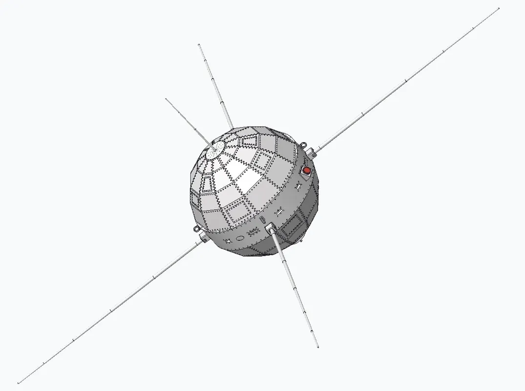 东方红一号卫星
|
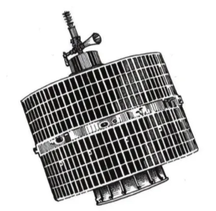 东方红二号(DFH-2)通信卫星平台
|
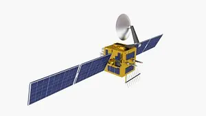 东方红三号卫星公用平台
|
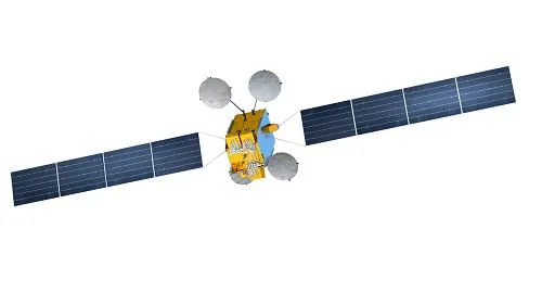 东方红四号增强型卫星公用平台
|
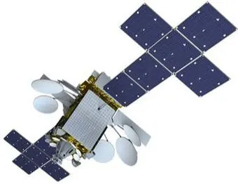 |
Over time, the Dongfanghong program evolved from a single experimental satellite into a family of standardized communications‑satellite buses that underpinned much of China’s later space infrastructure. The first-generation DFH‑2 bus, developed in the late 1970s, used spin stabilization and enabled China’s early geostationary communications missions. This was followed by the three‑axis‑stabilized DFH‑3 bus from the late 1980s and the higher‑capacity DFH‑4 platform, designed between 1999 and 2005, which supported both domestic and export communications satellites. The most recent DFH‑5 bus represents a fourth‑generation, large, three‑axis‑stabilized platform designed for high‑power payloads, demonstrating how Dongfanghong gradually became a modular, upgradable standard used across multiple satellite missions and customers.
Shijian: A Laboratory in the Sky
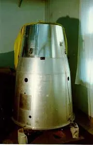
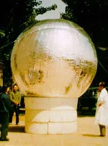
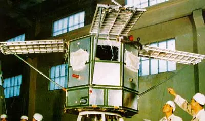
If Dongfanghong was China’s “first shout into space,” the Shijian (“Practice”) series became the country’s toolbox for trying out new ideas in orbit. Since 1971, Shijian satellites have tested technologies ranging from materials and sensors to control systems, often quietly validating components that would later fly on major missions. Among the most eye‑catching was Shijian‑10, a recoverable space laboratory launched in 2016 that spent nearly two weeks running 19 microgravity experiments before returning to Earth.
Inside Shijian‑10’s compact cabin, tiny flames behaved strangely without gravity, helping scientists better understand combustion, while droplets and fluids floated in ways impossible to reproduce on the ground, giving new insights into fluid physics and materials processing. Biologists used the mission to study life processes in space, from the early development of embryos to how microorganisms adapt to weightlessness. When the capsule parachuted back to the landing site, researchers rushed forward like parents greeting a child returning from a long journey, eager to open the hatch and retrieve hard drives, samples, and experiment racks filled with data. For many of them, Shijian‑10 made the aerospace spirit tangible: only by daring to send delicate experiments into a harsh environment can we push the frontiers of knowledge.
Inside Shijian‑10’s compact cabin, tiny flames behaved strangely without gravity, helping scientists better understand combustion, while droplets and fluids floated in ways impossible to reproduce on the ground, giving new insights into fluid physics and materials processing. Biologists used the mission to study life processes in space, from the early development of embryos to how microorganisms adapt to weightlessness. When the capsule parachuted back to the landing site, researchers rushed forward like parents greeting a child returning from a long journey, eager to open the hatch and retrieve hard drives, samples, and experiment racks filled with data. For many of them, Shijian‑10 made the aerospace spirit tangible: only by daring to send delicate experiments into a harsh environment can we push the frontiers of knowledge.
 实践(2A)
|
 实践(2B)
|
 实践(2)号
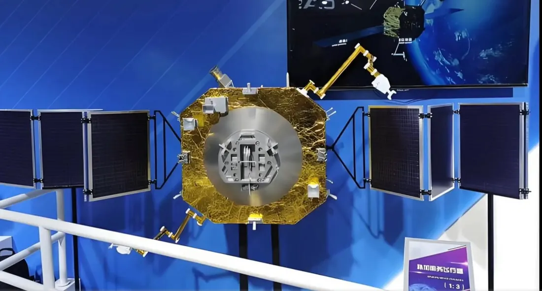 实践二十五号
|
Fengyun: Shepherds of Wind and Cloud
 |
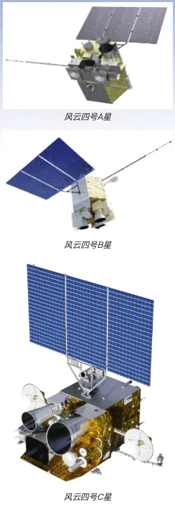 |
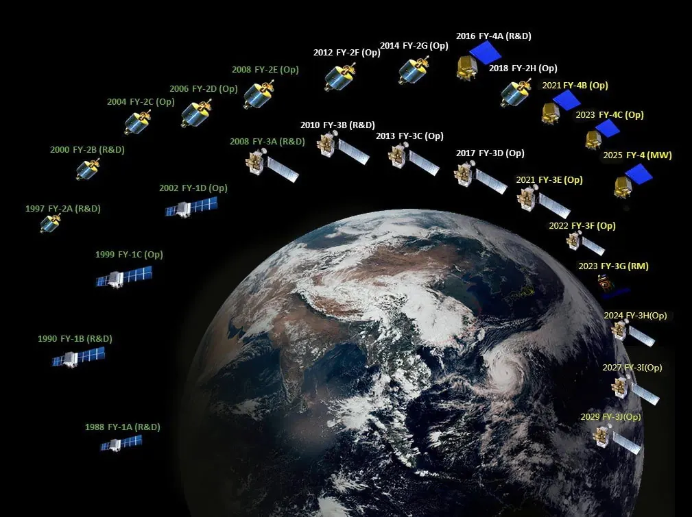
The Fengyun (“Wind and Cloud”) meteorological satellites opened a new era in China’s weather forecasting. With the launch of Fengyun‑1 in 1990, meteorologists gained their own polar‑orbiting “cloud camera” to watch typhoons, cold fronts, and monsoon systems from above. Later generations such as Fengyun‑4 moved into geostationary orbit, hovering over the equator with powerful imagers and sounders that can scan China and its surrounding regions every few minutes.
From 36,000 kilometers above Earth, Fengyun‑4 watches the birth and growth of tropical cyclones almost in real time, tracks the spread of heavy rain bands, and monitors dust storms and cold surges. Its data feed directly into numerical weather models, improving the accuracy of forecasts and the timeliness of warnings. For many forecasters, each colorful cloud‑top image on their screens is also a quiet reminder of the engineers behind the scenes who ensured that the satellite’s “eyes” remain sharp through long years of sun, vacuum, and radiation.
From 36,000 kilometers above Earth, Fengyun‑4 watches the birth and growth of tropical cyclones almost in real time, tracks the spread of heavy rain bands, and monitors dust storms and cold surges. Its data feed directly into numerical weather models, improving the accuracy of forecasts and the timeliness of warnings. For many forecasters, each colorful cloud‑top image on their screens is also a quiet reminder of the engineers behind the scenes who ensured that the satellite’s “eyes” remain sharp through long years of sun, vacuum, and radiation.
Haiyang: Guardians of the Blue Planet
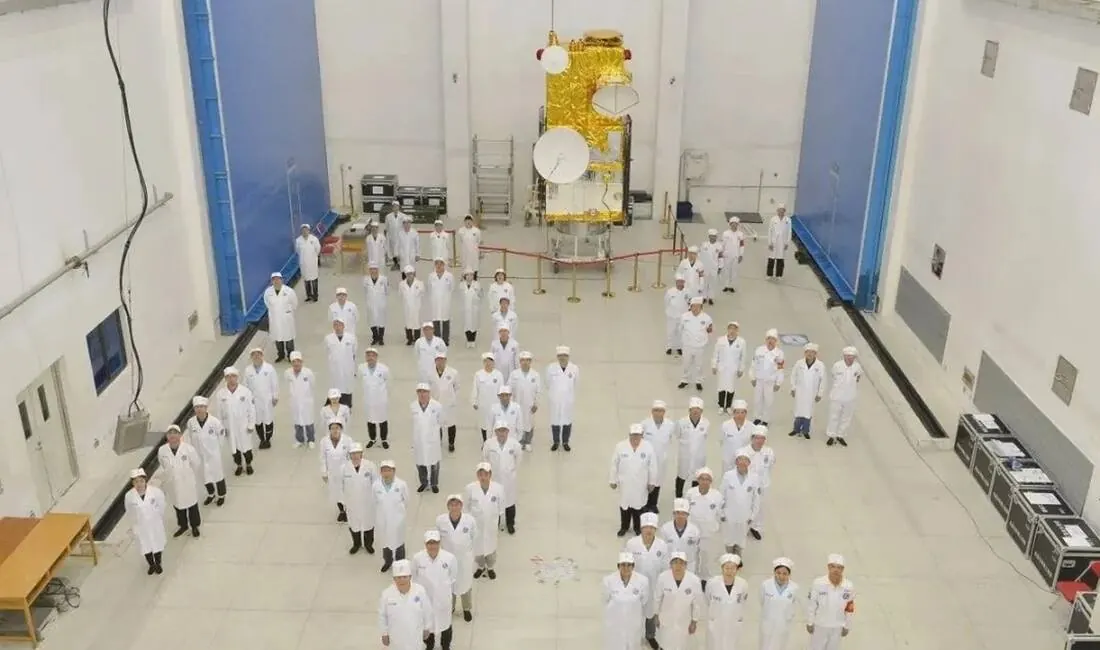 Some members of the HY-2C development team posing with the satellite. (China Aerospace Science and Technology Corporation)
|
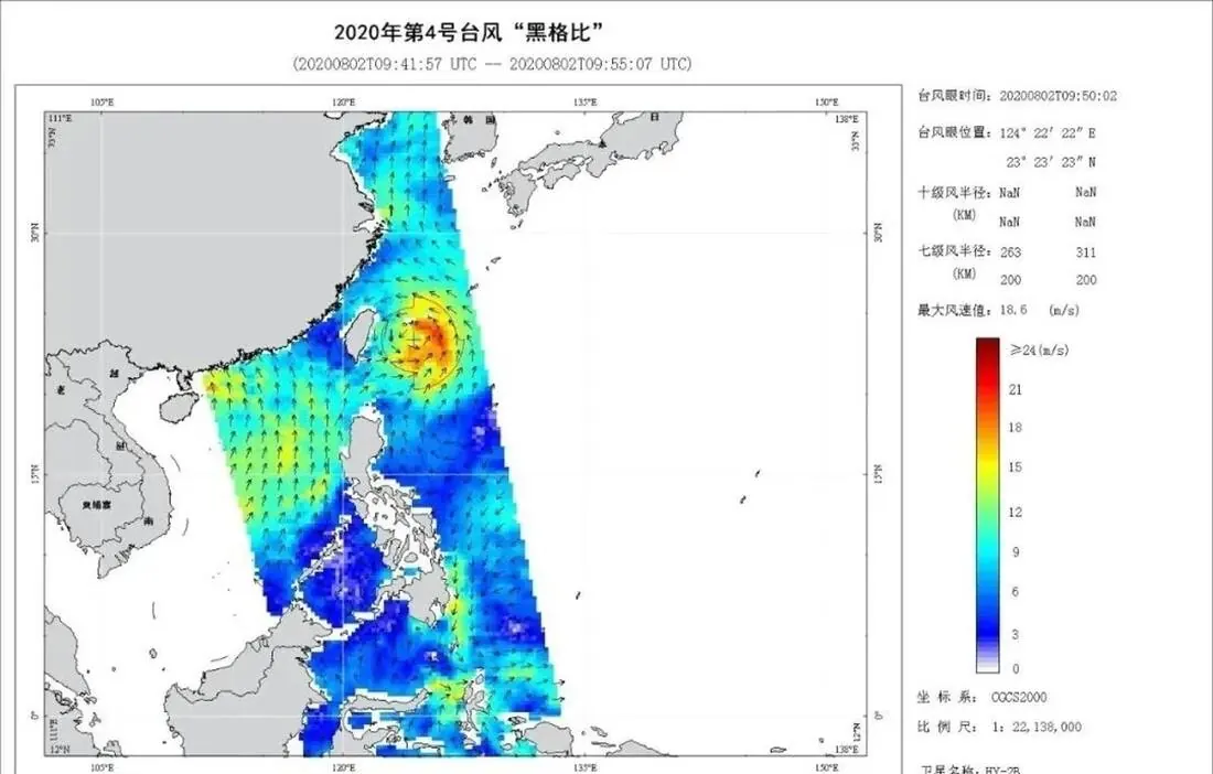 HY-2B satellite monitoring of the dynamic movement and evolution process of Typhoon Hagupit (No. 4, 2020) (National Satellite Ocean Application Service)
|
Where Fengyun watches clouds, Haiyang (“Ocean”) satellites keep an eye on the seas. Haiyang‑1A, launched on 15 May 2002, was China’s first satellite dedicated to monitoring ocean color and surface temperature, measuring chlorophyll, suspended sediments, and other indicators of ocean health. By turning subtle changes in sea color into data, it helped researchers track algal blooms, study fisheries, and improve models of coastal ecosystems.
Follow‑on satellites such as Haiyang‑2 and Haiyang‑3 added instruments to measure sea‑surface height, waves, and marine winds, enabling near‑real‑time monitoring of storm surges, ocean currents, and sea‑ice edges. Their measurements support safer shipping, better fisheries management, and more accurate forecasts of phenomena like El Niño that can reshape weather patterns around the world. For those who work with Haiyang data, it feels as if an invisible fleet is patrolling the oceans, sending back reports that help protect both sailors and sea creatures.
Follow‑on satellites such as Haiyang‑2 and Haiyang‑3 added instruments to measure sea‑surface height, waves, and marine winds, enabling near‑real‑time monitoring of storm surges, ocean currents, and sea‑ice edges. Their measurements support safer shipping, better fisheries management, and more accurate forecasts of phenomena like El Niño that can reshape weather patterns around the world. For those who work with Haiyang data, it feels as if an invisible fleet is patrolling the oceans, sending back reports that help protect both sailors and sea creatures.
LuTan: Land Exploration from Above
 |
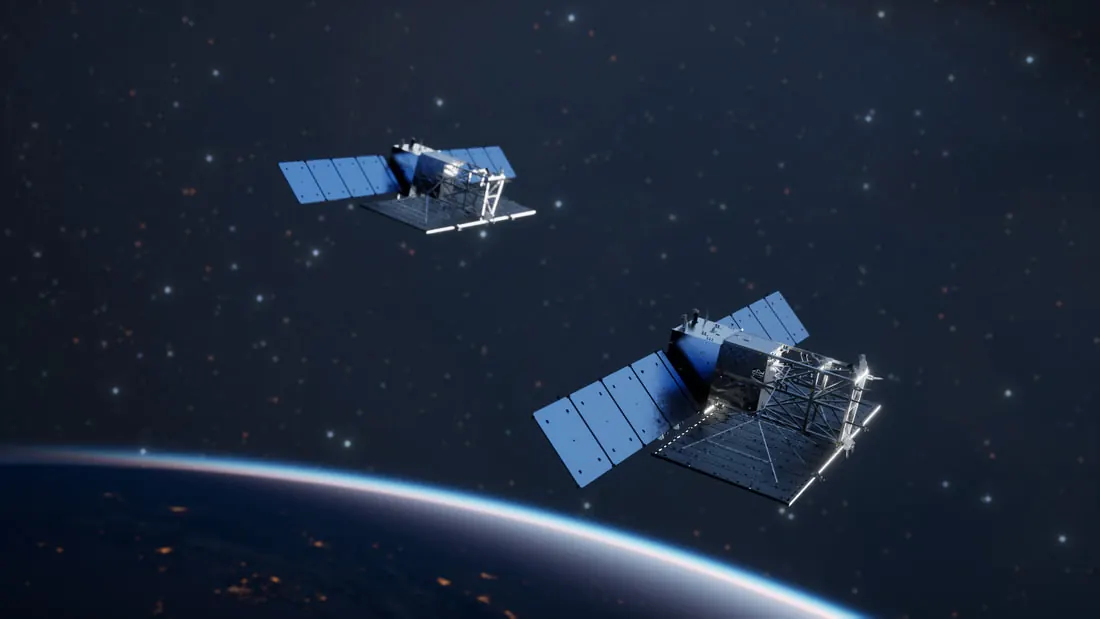 |
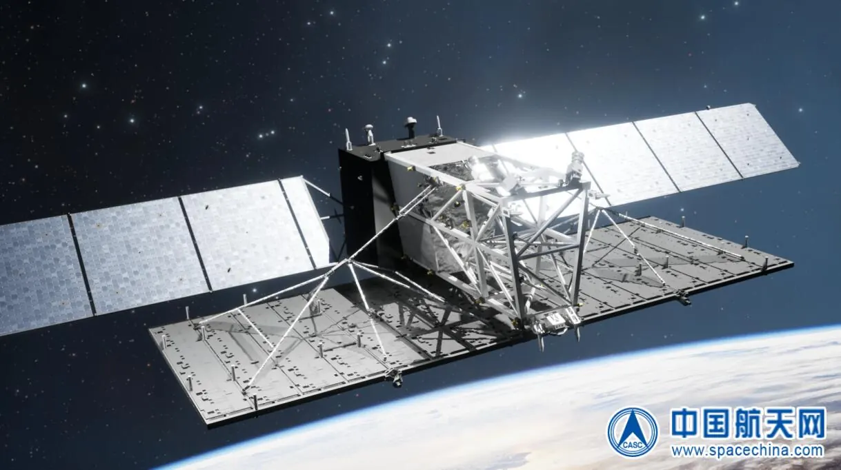
The LuTan (Land Exploration‑1) satellites represent a new generation of radar‑based Earth observation focused on the solid Earth and geological hazards. Using large L‑band synthetic‑aperture radar antennas, LuTan‑1 satellites can capture high‑resolution images of the ground day or night, in all weather conditions. From about 600 kilometers up, they can detect subtle ground movements, helping monitor landslide‑prone slopes, active faults, and areas at risk of subsidence.
One of the LuTan satellites carries one of the largest SAR antennas China has yet flown, with an area of more than 33 square meters, giving it powerful imaging capabilities. Its data help geologists and disaster‑management agencies watch for early signs of instability, such as slow ground deformation that might precede a landslide or the gradual sinking of soft ground in cities. The mission illustrates how advances in radar technology can be turned into practical tools for protecting people’s lives and property.
One of the LuTan satellites carries one of the largest SAR antennas China has yet flown, with an area of more than 33 square meters, giving it powerful imaging capabilities. Its data help geologists and disaster‑management agencies watch for early signs of instability, such as slow ground deformation that might precede a landslide or the gradual sinking of soft ground in cities. The mission illustrates how advances in radar technology can be turned into practical tools for protecting people’s lives and property.
Daqi: Monitoring the Air We Breathe
|
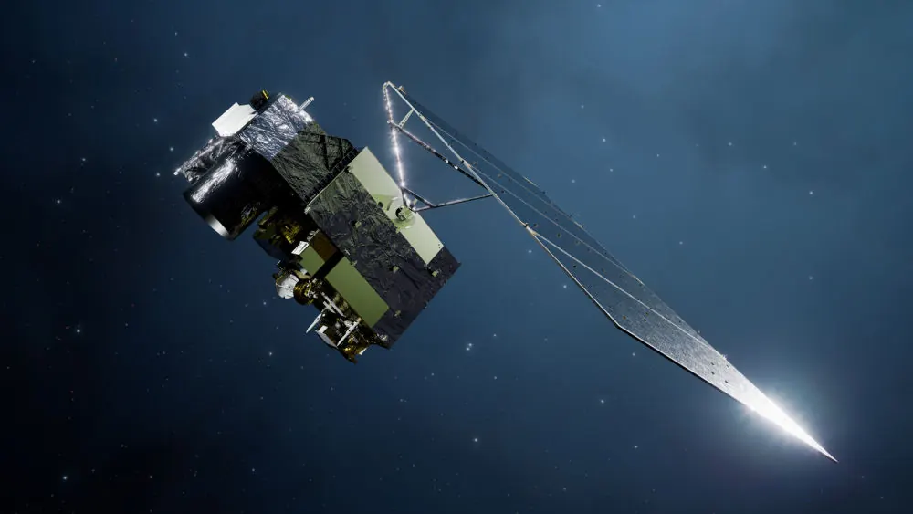
The Daqi Atmospheric Environment Monitoring Satellites (AEMS), including Daqi‑1 launched in April 2022, are dedicated to observing the composition and quality of the air around our planet. Equipped with instruments such as atmospheric lidar, polarization scanners, and hyperspectral atmospheric composition detectors, Daqi‑1 measures aerosols, clouds, and greenhouse gases like carbon dioxide and methane from its sun‑synchronous orbit.
These measurements help scientists study air pollution, track haze events, monitor long‑range transport of aerosols, and improve estimates of carbon emissions and sinks. The data also support research on climate change and ecological shifts, while helping environmental agencies evaluate the effectiveness of pollution‑control measures. For many young researchers, seeing “their” instruments ride into space on Daqi‑1 transforms abstract talk about climate and air quality into a concrete, long‑term commitment to protect the atmosphere we all share. |
 |
Remote Sensing Satellites: Earth’s Detailed Portrait
China’s broader Remote Sensing Satellite Series provides high‑resolution views of the land surface to support resource exploration, environmental monitoring, and disaster management. Equipped with multi‑spectral and panchromatic imagers, these satellites can tell cropland from forest, wetlands from deserts, and new construction from older urban areas. Their images feed into decisions about where to build roads and reservoirs, where to protect habitats, and how to track land‑use changes over time.
In major disasters, such as earthquakes or floods, remote‑sensing satellites can quickly map collapsed buildings, blocked roads, and flooded valleys so that rescue teams know where help is needed most. During the recovery phase, repeated observations show how rebuilding progresses and whether landslides or secondary hazards remain a threat. The engineers who design these satellites often say that the most rewarding moments come not at launch, but when they see their images pinned up on the walls of emergency command rooms or planning offices, guiding real‑world decisions.
In major disasters, such as earthquakes or floods, remote‑sensing satellites can quickly map collapsed buildings, blocked roads, and flooded valleys so that rescue teams know where help is needed most. During the recovery phase, repeated observations show how rebuilding progresses and whether landslides or secondary hazards remain a threat. The engineers who design these satellites often say that the most rewarding moments come not at launch, but when they see their images pinned up on the walls of emergency command rooms or planning offices, guiding real‑world decisions.
 |
 |
Gaofen: High‑Resolution Eyes in the Sky
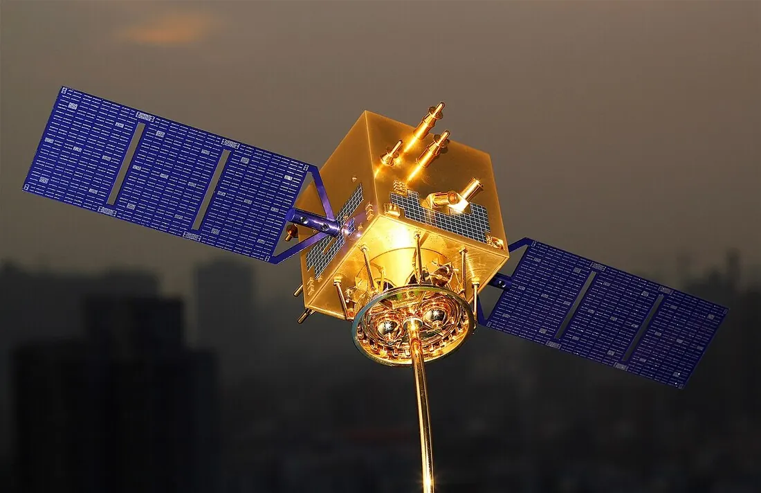
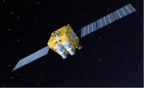
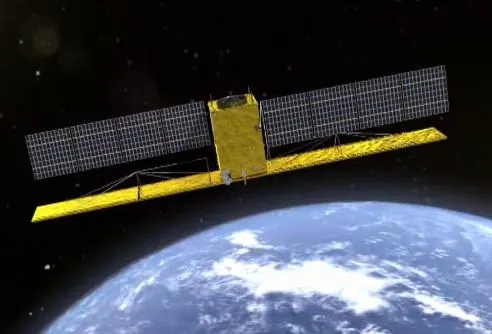
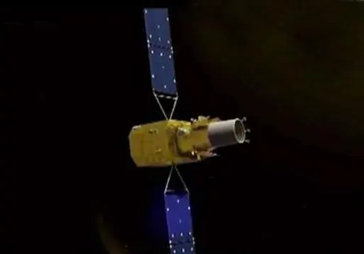
The Gaofen (“High Resolution”) series, part of the High‑Resolution Earth Observation System launched in 2010, was designed to provide even sharper images and more specialized sensors. Gaofen‑1, launched in 2013, marked a major step forward in optical remote sensing with high spatial resolution and multi‑spectral imaging, enabling detailed views of fields, towns, and infrastructure.
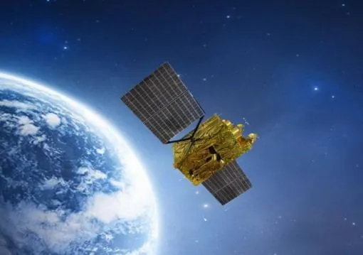
Subsequent satellites such as Gaofen‑2, Gaofen‑3, and later missions added higher resolutions, radar imaging, stereo cartography, and atmospheric sensors, expanding their applications from mapping and agriculture to ship tracking, disaster assessment, and even atmospheric composition monitoring. Some Gaofen satellites can see fine details on the ground; others can “see” through clouds and at night using synthetic‑aperture radar. Together, they provide a dense flow of data that supports everything from national land surveys and precision farming to monitoring air pollution and enforcing environmental regulations.
Subsequent satellites such as Gaofen‑2, Gaofen‑3, and later missions added higher resolutions, radar imaging, stereo cartography, and atmospheric sensors, expanding their applications from mapping and agriculture to ship tracking, disaster assessment, and even atmospheric composition monitoring. Some Gaofen satellites can see fine details on the ground; others can “see” through clouds and at night using synthetic‑aperture radar. Together, they provide a dense flow of data that supports everything from national land surveys and precision farming to monitoring air pollution and enforcing environmental regulations.
 高分一号卫星
|
 高分二号
|
 高分三号
|
 高分四号
|
CBERS: China–Brazil Earth Resources Satellites
|
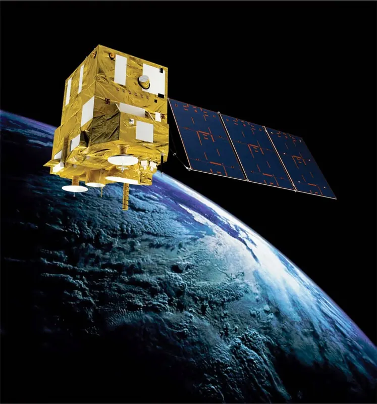
The China–Brazil Earth Resources Satellite program (CBERS) shows how space technology can become a bridge between nations. The first satellite, CBERS‑1 (also known as ZY‑1), was launched on 14 October 1999 as a joint project between China and Brazil. With multi‑spectral cameras and wide‑swath imagers, CBERS satellites have provided crucial data on forests, croplands, water bodies, and urban growth across South America, China, and beyond.
CBERS imagery has been used to monitor deforestation in the Amazon, track droughts, plan new infrastructure, and support environmental protection policies. One distinctive feature of the program is its emphasis on open data distribution in partner countries, helping scientists, students, and government agencies access satellite information without prohibitive costs. Through CBERS, the aerospace spirit extends outward: two countries share risks, costs, and knowledge so that both can better understand and protect their natural resources. |
 |
Beidou: The Compass of the New Era
 |
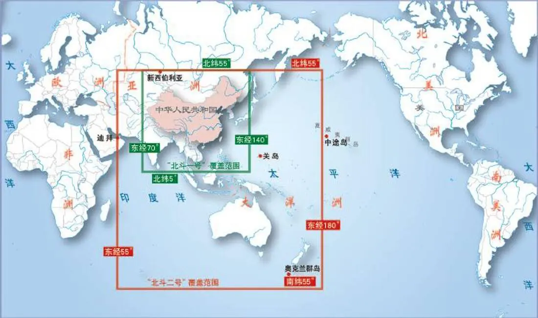 |
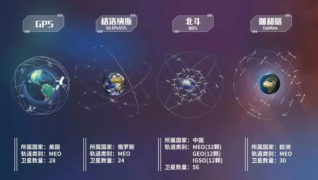
High above the weather and imaging satellites, the Beidou navigation constellation forms a network of timing and positioning beacons that quietly answer the everyday question “Where am I?” for users on land, at sea, and in the air. Starting from a regional system serving China and its neighbors around 2000, Beidou evolved through carefully planned stages into a full global network of more than 30 satellites by 2020. Today, Beidou supports precise positioning, navigation, timing, and short‑message services for trucks, ships, aircraft, smartphones, precision agriculture, autonomous vehicles, and emergency rescue teams, often down to meter‑level accuracy in open environments.
The path to a global Beidou was not smooth. International rules on radio frequencies required China to launch certain satellites before strict deadlines or risk losing access to crowded spectrum bands used by other navigation systems. Engineers worked under intense time pressure, sometimes monitoring test satellites around the clock so no anomaly would slip by during critical activation windows. In one key phase, a Beidou satellite had to be launched and its signals activated just before a strict “use it or lose it” deadline, turning every hour of testing into a race against the clock.
As the constellation expanded, Beidou began to show its strengths: robust service in complex terrain, enhanced short‑message functions for remote regions, and improved resistance to interference for critical users. In everyday life, Beidou helps guide logistics fleets and high‑speed trains, supports precision operations on farms and construction sites, and provides vital location and messaging support for disaster‑relief teams working in areas where ground networks have failed. When the final Beidou‑3 satellite was successfully placed in orbit and the system declared operational, many in the control centers felt not just relief but a deep sense of independence and responsibility: China now had its own global navigation “compass,” and the world had gained another strong, open system to rely on.
The path to a global Beidou was not smooth. International rules on radio frequencies required China to launch certain satellites before strict deadlines or risk losing access to crowded spectrum bands used by other navigation systems. Engineers worked under intense time pressure, sometimes monitoring test satellites around the clock so no anomaly would slip by during critical activation windows. In one key phase, a Beidou satellite had to be launched and its signals activated just before a strict “use it or lose it” deadline, turning every hour of testing into a race against the clock.
As the constellation expanded, Beidou began to show its strengths: robust service in complex terrain, enhanced short‑message functions for remote regions, and improved resistance to interference for critical users. In everyday life, Beidou helps guide logistics fleets and high‑speed trains, supports precision operations on farms and construction sites, and provides vital location and messaging support for disaster‑relief teams working in areas where ground networks have failed. When the final Beidou‑3 satellite was successfully placed in orbit and the system declared operational, many in the control centers felt not just relief but a deep sense of independence and responsibility: China now had its own global navigation “compass,” and the world had gained another strong, open system to rely on.
Tianlian: The Sky Chain of Communication
|
Tianlian (“Sky Chain”) data‑relay satellites form an invisible communication backbone linking low‑Earth‑orbit spacecraft with ground stations. Operating in geostationary orbit, these satellites receive signals from missions such as Shenzhou crewed spacecraft, resource satellites, and scientific payloads, then forward the data to ground antennas that might otherwise be out of range.
By sharply reducing communication blackouts, Tianlian improves safety and efficiency for a wide range of missions. Telemetry, tracking data, and commands can flow almost continuously, allowing ground controllers to monitor a spacecraft’s health, adjust its orbit, or respond quickly to anomalies. For astronauts, knowing that there is almost always a “listening ear” overhead can be an important source of psychological comfort as well as operational security, embodying the aerospace spirit’s focus on reliability and teamwork. |
|
Wukong: Hunting for Dark Matter
|
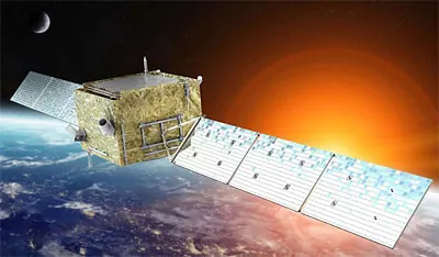
The Dark Matter Particle Explorer (DAMPE), nicknamed “Wukong” after the Monkey King, is China’s first satellite dedicated to hunting for the mysterious dark matter thought to make up most of the universe’s mass. Launched at the end of 2015 into a sun‑synchronous orbit about 500 kilometers above Earth, Wukong uses a stack of finely tuned detectors to measure high‑energy electrons, gamma rays, and cosmic rays with exceptional precision.
Over the years, Wukong has recorded billions of cosmic particles and revealed intriguing features in the electron and positron energy spectrum that may hint at new physics. Scientists sometimes compare it to the Monkey King’s “fiery eyes”: just as Wukong could see through demons in disguise, the satellite tries to see hidden traces of dark matter in subtle deviations within streams of particles. |
 |
Mozi: Quantum Messages from Space
Not all satellites look down at Earth; some are built to explore the deepest questions of physics. The Quantum Science Experiment Satellite, nicknamed “Mozi” after the ancient philosopher who pondered the nature of light, is the world’s first satellite dedicated to quantum communication experiments. Launched in August 2016, Mozi has successfully demonstrated long‑distance quantum entanglement and quantum key distribution over distances of more than a thousand kilometers, achievements that once sounded like science fiction.
By distributing quantum keys between space and ground stations, Mozi points toward future communications networks in which eavesdropping becomes nearly impossible, because any attempt to intercept the quantum signal would immediately disturb it. For the scientists and engineers involved, watching fragile quantum states survive launch, orbit the Earth, and return meaningful data is both nerve‑wracking and exhilarating. In their eyes, Mozi is a symbol of the aerospace spirit at its most daring: turning extremely abstract physics into concrete engineering, and then using that engineering to build safer, more trustworthy systems for society.
By distributing quantum keys between space and ground stations, Mozi points toward future communications networks in which eavesdropping becomes nearly impossible, because any attempt to intercept the quantum signal would immediately disturb it. For the scientists and engineers involved, watching fragile quantum states survive launch, orbit the Earth, and return meaningful data is both nerve‑wracking and exhilarating. In their eyes, Mozi is a symbol of the aerospace spirit at its most daring: turning extremely abstract physics into concrete engineering, and then using that engineering to build safer, more trustworthy systems for society.
Xihe and Kuafu: Chasing the Sun
China’s first dedicated solar exploration satellite, Xihe, was launched in October 2021 into a sun‑synchronous orbit about 500–570 kilometers above Earth. Named after the sun goddess in Chinese mythology, Xihe carries instruments to perform H‑alpha spectral imaging of the full solar disk, capturing fine details of solar flares, filaments, and other dynamic phenomena in the Sun’s lower atmosphere. By obtaining high‑precision spectral lines of hydrogen and elements such as silicon and iron, Xihe helps scientists derive the temperature, density, and velocity of the solar atmosphere and better understand how solar eruptions are triggered.
Kuafu‑1, formally known as the Advanced Space‑based Solar Observatory (ASO‑S), is an “all‑rounder” solar probe launched in October 2022 to monitor solar flares, coronal mass ejections, and the Sun’s magnetic field simultaneously. Named after the giant in Chinese legend who chased the Sun, Kuafu‑1 carries three main instruments—a solar telescope, a hard X‑ray imager, and a full‑disk vector magnetograph—and has already detected hundreds of solar flares and returned tens of terabytes of data. Covering the current peak of the solar activity cycle, Xihe and Kuafu together turn the Sun into a carefully observed “laboratory,” with their findings feeding into improved space‑weather forecasts that protect satellites, power grids, and communication systems on Earth.
Kuafu‑1, formally known as the Advanced Space‑based Solar Observatory (ASO‑S), is an “all‑rounder” solar probe launched in October 2022 to monitor solar flares, coronal mass ejections, and the Sun’s magnetic field simultaneously. Named after the giant in Chinese legend who chased the Sun, Kuafu‑1 carries three main instruments—a solar telescope, a hard X‑ray imager, and a full‑disk vector magnetograph—and has already detected hundreds of solar flares and returned tens of terabytes of data. Covering the current peak of the solar activity cycle, Xihe and Kuafu together turn the Sun into a carefully observed “laboratory,” with their findings feeding into improved space‑weather forecasts that protect satellites, power grids, and communication systems on Earth.
From Dongfanghong’s first song in space to Beidou’s global “compass,” from Haiyang’s sea‑color maps to Daqi’s atmospheric measurements, from LuTan’s ground‑motion maps to Wukong’s hunt for dark matter and Xihe and Kuafu’s portraits of the Sun, China’s satellites trace a journey from catching up to standing shoulder to shoulder with other space powers—and in some areas, pioneering new paths. They forecast typhoons, monitor oceans and forests, guide ships and aircraft, support disaster relief, enable secure communication, and open windows onto the fundamental laws of nature. Behind each mission stands a team of people who embody the aerospace spirit by taking on hard problems, accepting long periods of quiet effort, and sharing both risks and honors.