Air Masses and Their Source Regions
An air mass is a large body of air with relatively uniform temperature and humidity, formed over a particular source region such as oceans, deserts, or high‑latitude land. Air masses are commonly labeled by moisture (continental “c” for dry, maritime “m” for moist) and temperature (Tropical “T”, Polar “P”, Arctic “A”).
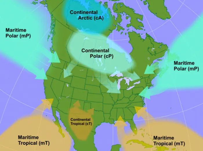
For example:
- Continental polar (cP) air mass is cold and dry and often affects East Asia in winter, while
- Maritime tropical (mT) air mass is warm and humid and can bring moist air from the oceans toward southern China and Hong Kong.
Fronts as Boundaries Between Air Masses
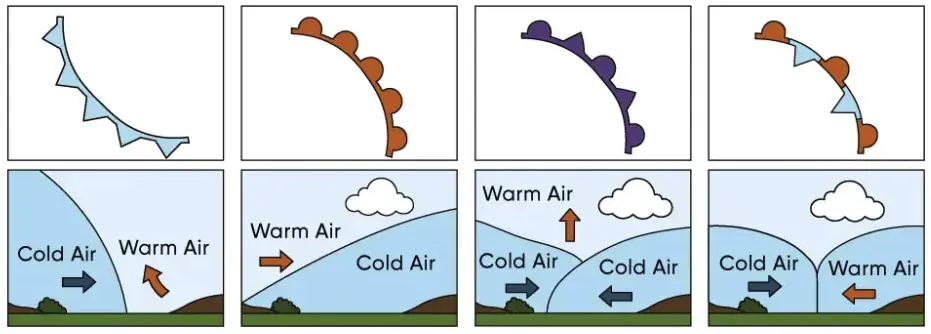
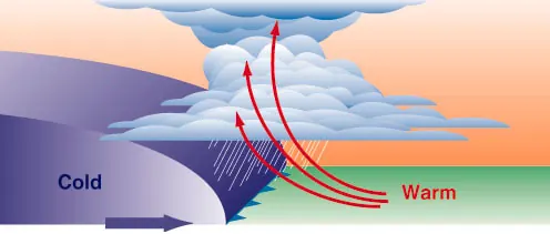
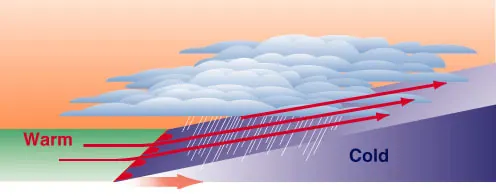
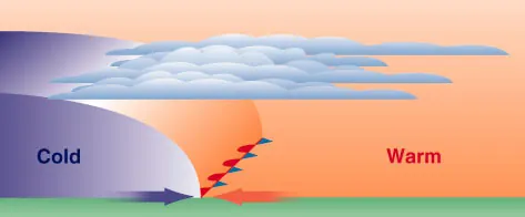
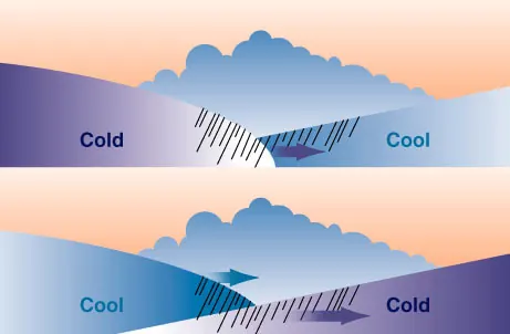
A front is a boundary between two air masses with different temperature and humidity. When air masses meet, their contrasting properties generate organized zones of cloud, precipitation, and wind shifts.
|
|
|
|
Satellite Views of Fronts
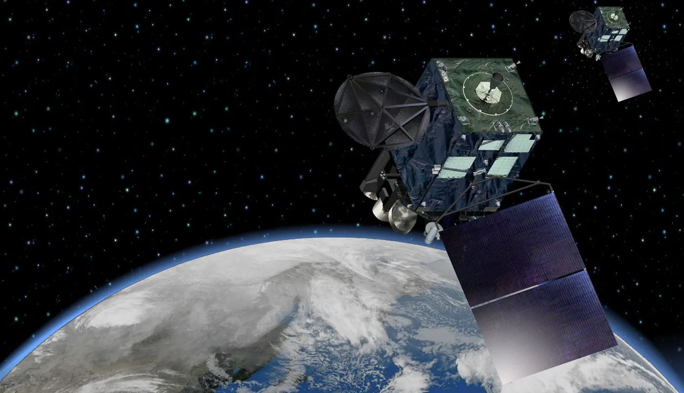 Himawari‑8 (Japan)
|
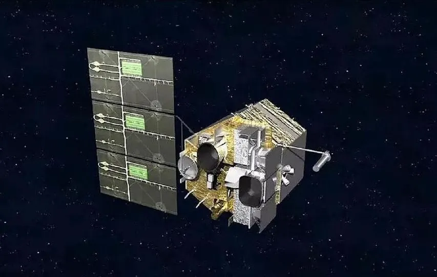 FungYun-4 (China)
|
Modern meteorology uses satellites to monitor fronts over oceans and remote regions. Geostationary satellites such as Himawari‑8 and FungYun-4 remain over the same point on the equator and provide frequent full‑disk images in visible and infrared bands, with resolutions down to hundreds of meters and updates on the order of 10 minutes.
Polar‑orbiting satellites pass over the poles in low Earth orbit, providing high‑resolution swaths and vertical profiles of temperature and humidity that help describe the structure of air masses.
In visible imagery, cold and warm fronts often appear as organized bands or arcs of clouds, while infrared imagery shows temperature contrasts between air masses and the tops of cloud systems. Multi‑spectral products combine several wavelength channels so that forecasters can distinguish cloud types, identify jet‑stream features, and refine the position of frontal boundaries.
Polar‑orbiting satellites pass over the poles in low Earth orbit, providing high‑resolution swaths and vertical profiles of temperature and humidity that help describe the structure of air masses.
In visible imagery, cold and warm fronts often appear as organized bands or arcs of clouds, while infrared imagery shows temperature contrasts between air masses and the tops of cloud systems. Multi‑spectral products combine several wavelength channels so that forecasters can distinguish cloud types, identify jet‑stream features, and refine the position of frontal boundaries.
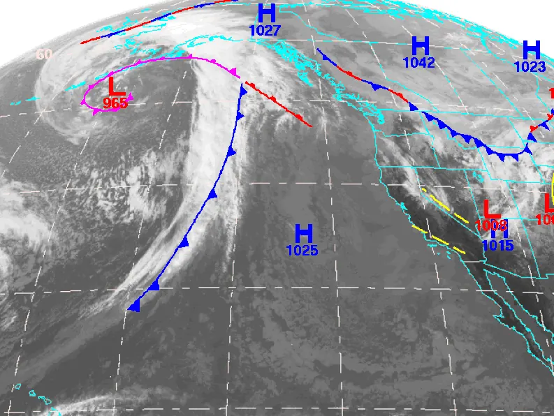
- Cold front – Cold air advances under warm air; narrow band of showers or thunderstorms, then cooler, drier, clearer air and wind shift.
- Warm front – Warm air glides over retreating cold air; layered clouds, steady light–moderate rain, then milder, more humid air.
- Stationary front – Boundary stalls; prolonged clouds and periods of rain or drizzle near the front, little movement.
- Occluded front – Cold front overtakes warm front; mixed cloud layers and widespread rain, often with a broad, cool, cloudy area.
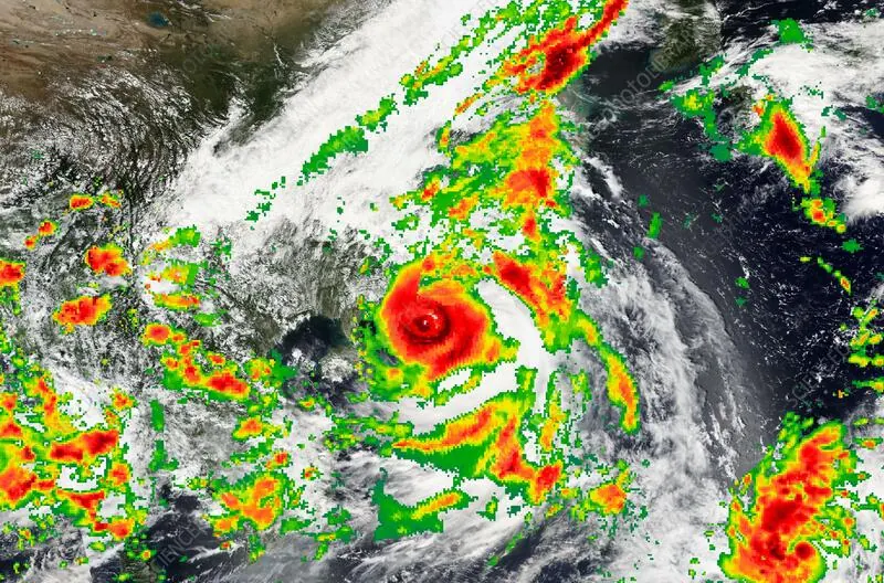
Satellite image of Typhoon Ragasa with an infrared heatmap.
Multi‑spectral products combine several visible and infrared channels to highlight features relevant to fronts, such as cloud‑top height, phase (water or ice), and low‑level moisture. Over East Asia, Himawari‑8 and Fengyun‑4 imagery are famous for monitoring weather.
Activity - From Static to Stormy: Animating the Atmosphere with AI

Click to image to proceed with Grok
|
Step 1: Sign Up & Login
|
 |
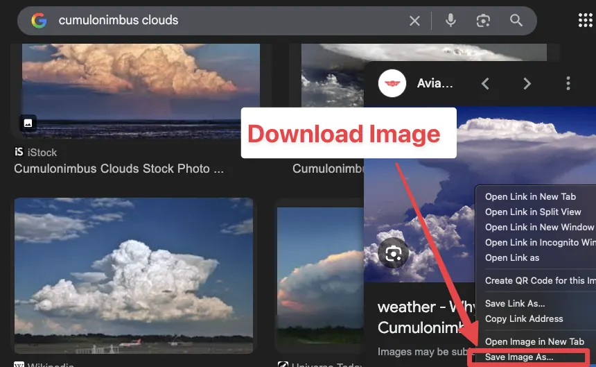
Step 2: Choose Your Cloud & Download Your Image
|
Before you start, you need a high-quality "base" image.
1. Choose a Category: Pick one of the four types: Cumulus, Cirrus, Cumulonimbus, or Stratus. 2. To Download:
|
 |
|
Step 3. Uploading Your Image
|
 |
|
Step 4: Animate
Copy & Paste your Prompt: Use the prompt below that matches your cloud! |
 |
The Scientific Prompts
- For Cumulus (Fair Weather):
"Animate this image of Cumulus clouds. Make the clouds drift slowly across the blue sky. Add a subtle 'bubbling' effect to the tops to show warm air rising (convection), keeping the movement gentle." - For Cirrus (High Altitude):
"Animate these Cirrus clouds to show high-altitude winds. The wispy white strands should streak quickly across the frame. The ground should stay still while the clouds move fast with the jet stream." - For Cumulonimbus (Storm Cloud):
"Animate this Cumulonimbus cloud to show a storm developing. The cloud should grow vertically and expand at the top. Add a slight darkening at the base and a flickering light effect to simulate lightning." - For Stratus (Overcast/Fog):
"Animate these Stratus clouds to look like a heavy, overcast day. The movement should be very slow and 'heavy,' with the mist creeping slightly or lifting slowly to reveal the ground."
|
Step 5: Check Your Work & Discuss with your partner
Watch your 6-second video.
|
 |