Satellites
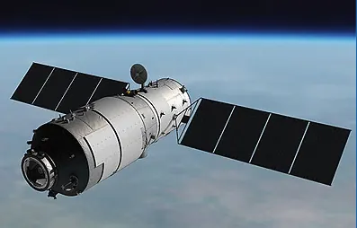
Satellites are objects placed into orbit around Earth to perform specific tasks. Though they operate high above us, satellites have become deeply integrated into daily life—supporting television broadcasts, navigation apps on mobile phones, weather forecasts, and environmental monitoring. In a boarder scope, satellites in general can be classified by their functions into three main categories:
China has developed a family of satellites across all these categories. From its first satellite in 1970 to the latest lunar and interplanetary missions, Chinese spacecraft now support applications ranging from daily weather reports to global navigation and deep space exploration.
- Communication satellites act like "space messengers," relaying television signals, telephone calls, and internet data across continents.
- Navigation satellites function as "space compasses," providing positioning and timing information for users worldwide.
- Remote sensing satellites serve as "space eyes," observing Earth's surface, oceans, and atmosphere to support mapping, agriculture, disaster response, and climate research .
China has developed a family of satellites across all these categories. From its first satellite in 1970 to the latest lunar and interplanetary missions, Chinese spacecraft now support applications ranging from daily weather reports to global navigation and deep space exploration.
Famous Chinese Satellite Series
In the sections below, we are introducing the famous satellite programs from China, but some programs, namely Chang'e and Tianwen, encompass more than just satellites, but also landers. They are included here because there are specific satellites in those programs, and also because of how famous they are.
 |
Chang'e (Chinese Lunar Exploration Program)
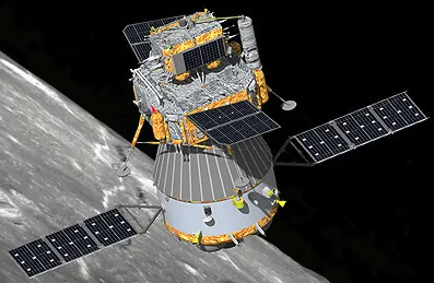
The Chang’e program is a series of Chinese space missions that send robotic spacecraft to study the Moon by flying around it, landing on it, and bringing Moon rocks back to Earth. Some Chang’e spacecraft orbit the Moon and make detailed maps of its surface, while others land and release small rovers that drive on the ground and take photos and measurements of the soil and rocks. Newer Chang’e missions collect samples of lunar soil and rock and return them to Earth, so scientists can test them in laboratories to learn how the Moon was formed and how it has changed over time. |
 |
Tianwen (Chinese Interplanetary Mission)
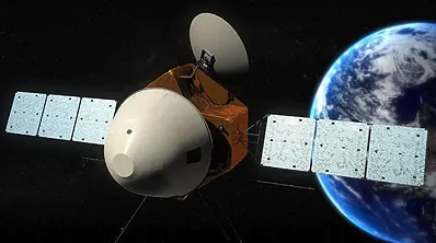
Tianwen is the name for China’s interplanetary missions that send spacecraft to other planets, starting with Tianwen‑1 to Mars. Tianwen‑1 includes an orbiter that flies around Mars and a lander with the Zhurong rover, which has driven on the Martian surface to take pictures and measure rocks, soil, and weather. By studying Mars’ ground, air, and signs of past water, Tianwen helps scientists compare Mars with Earth and plan future trips to other places in the Solar System. |
 |
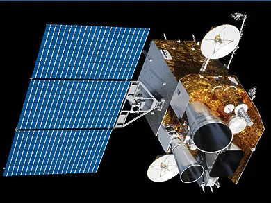
Gaofen (High-resolution Earth Observation System)
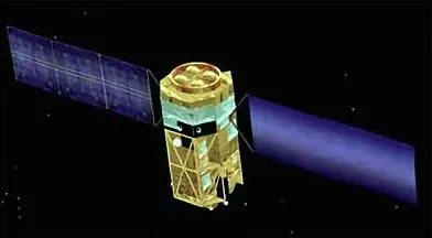
The Gaofen program is a system of satellites designed by China to observe the Earth. "Gaofen" translates to "high resolution," which means these satellites are equipped with powerful cameras that can take very clear and detailed pictures of the planet's surface from space. These images help people see how land is being used, for example, by showing the layout of cities, farms, and forests. The data from the Gaofen satellites is used for scientific research, resource management, and environmental protection, providing a precise way to track changes on the Earth's surface over time. |
 |
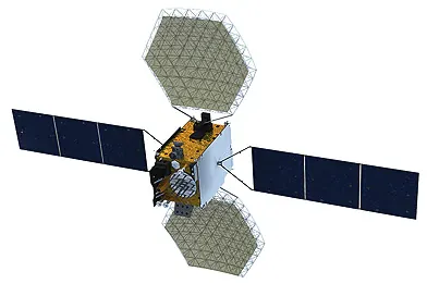
Fengyun (Meteorological Satellites)
The Fengyun program is a series of meteorological satellites developed by China. "Fengyun" translates to "wind and cloud," which describes the main purpose of these satellites: to study weather and climate. From their position orbiting the Earth, these satellites continuously monitor the planet's atmosphere. They gather data on cloud formations, air temperature, and other atmospheric conditions. This information is then used by scientists to create weather forecasts, helping to predict daily weather and track the movement of large weather systems like storms. |
 |
Beidou (Satellite Navigation System)
The Beidou program is China's satellite navigation system, which is made up of a large network of satellites orbiting the Earth. These satellites work together by continuously sending signals down to the ground. A special device called a receiver, which can be in a car or a phone, detects these signals from several satellites at the same time. By using the information from the signals, the receiver can calculate its exact position on the planet. This technology provides positioning and timing information that is used for navigation and other applications that require knowing a precise location. |
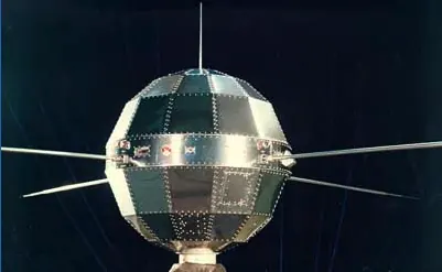 |
Dong Fang Hong (China's First Satellite Program)
The Dong Fang Hong program represents China's first series of satellites, beginning with the launch of Dong Fang Hong-1. The main purpose of this initial mission was to serve as an engineering test to demonstrate that China had the capability to build a satellite, successfully place it into Earth's orbit, and monitor its path from the ground. The satellite itself was a sphere that carried a radio transmitter, which broadcast a song back to Earth. This signal served as confirmation that the satellite was functioning correctly after reaching space. The success of this early program was the first step that led to the development of more complex satellites for other applications, such as communications. |
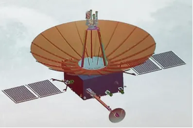 |
Queqiao (Relay Satellite For Lunar Missions)
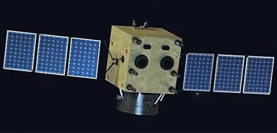
The Queqiao satellite is a special type of communications satellite known as a relay satellite. Its purpose is to solve a communication problem for missions to the far side of the Moon, which is the side that always faces away from Earth. Because radio signals cannot travel through the Moon, a rover or lander on the far side cannot send information directly back to ground control on Earth. Queqiao is placed at a specific point in space where it can see both the Earth and the far side of the Moon at the same time. It acts as a bridge, receiving signals from the lunar spacecraft and then transmitting, or relaying, those signals to Earth so scientists can receive the data. |
 |
Venezuela Remote Sensing Satellite (Earth Observation Satellites)
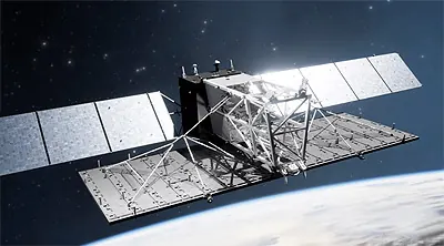
The Venezuela Remote Sensing Satellites (VRSS‑1 and VRSS‑2) are Earth‑observation satellites built and launched with help from China to take images of Venezuela from space. Their pictures are used for land‑use studies, environmental protection, disaster monitoring, crop yield estimation, and city planning, so the Venezuelan government and scientists can use the data for several purposes, such as resource inspection, environmental protection, urban planning, and monitoring the land to assist with agriculture. It serves as a tool for scientists and planners in Venezuela to study their country's geography from an orbital perspective. |
 |
Ludi Tance (Earth Observation Satellites)
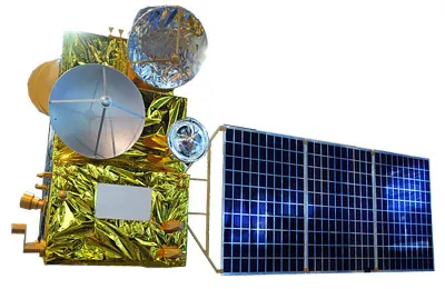
The Ludi Tance program, which means "Land Observation," is a series of Earth-observing satellites. These satellites use a special instrument called radar to create images of the Earth's surface. Unlike a regular camera that needs light, radar can see through clouds and can work during the day or night, allowing it to monitor the ground at all times. The main purpose of the Ludi Tance satellites is to provide data for land resource management, mapping, and helping with disaster prevention. This allows scientists and planners to keep a close watch on any changes happening to the land. |
 |
Haiyang (Ocean Monitoring Satellites)
The Haiyang program is a series of satellites from China designed to monitor the oceans. The name "Haiyang" means "ocean." These satellites orbit the Earth and use special instruments to collect data about the world's seas. They measure ocean characteristics such as the temperature of the water's surface, the height of waves, and the speed of wind over the water. This information is used for many practical applications, including helping to create marine weather forecasts, making travel safer for ships, and providing data for scientists who study ocean currents and the health of marine environments. |
Wukong & Micius (Scientific Experimental Satellites)
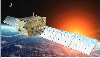
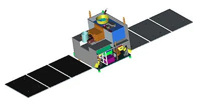
The Wukong satellite is a space telescope that looks for high-energy particles and rays coming from deep space. By studying these particles, scientists can learn more about the makeup of the universe, including things that cannot be seen directly. Micius (also called Mozi) is a quantum science satellite that tests new ways of sending very secure messages using quantum physics. It tests a method of sending information securely over very long distances by using special properties of light particles. These missions help engineers test new technologies and provide scientists with data for their research.
The Wukong satellite is a space telescope that looks for high-energy particles and rays coming from deep space. By studying these particles, scientists can learn more about the makeup of the universe, including things that cannot be seen directly. Micius (also called Mozi) is a quantum science satellite that tests new ways of sending very secure messages using quantum physics. It tests a method of sending information securely over very long distances by using special properties of light particles. These missions help engineers test new technologies and provide scientists with data for their research.
 |
 |
Tiangong 2
Tiangong-2, or "Heavenly Palace 2," was a Chinese space station launched on September 15, 2016. More accurately described as a space laboratory, its primary purpose was to function as a testbed for the advanced life support, scientific research, and orbital technologies required for China's large, permanent space station. During its operational life, Tiangong-2 hosted two astronauts from the Shenzhou-11 mission for 30 days, which at the time was China's longest crewed space mission. It also completed automated docking and propellant refueling tests with the Tianzhou-1 cargo spacecraft, a critical capability for sustaining a long-term presence in space.